
The theme for Week 6 of 52 Ancestors in 52 Weeks is Maps. I am following along with these prompts for researching my ancestors as given by Amy Johnson Crow. It is fun to see how each person interprets the different prompts.
I chose to work on mapping a day trip through a section of Scotland. My great Uncle Walter Kirkwood, who lived in Scotland, sent a letter to his brother (my grandfather) John Kirkwood in 1965. John lived in Central Iowa in the United States since 1910. Here is a part of the letter with trip number one.
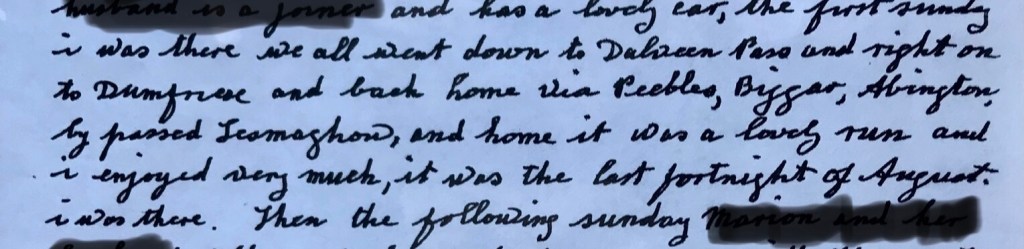
I tried to block out any names. Walter is describing a day trip with his niece and nephew. A trip to Scotland is definitely on my bucket list. I think it may be fun to enjoy the drive my Grand Uncle is describing so I mapped it on Google Maps. I ran it by some of the people who are in a Scotland Genealogy group on Facebook and learned the roads have probably changed some since 1965 when this letter was written but it should give me a similar experience. Here is the what I came up with.
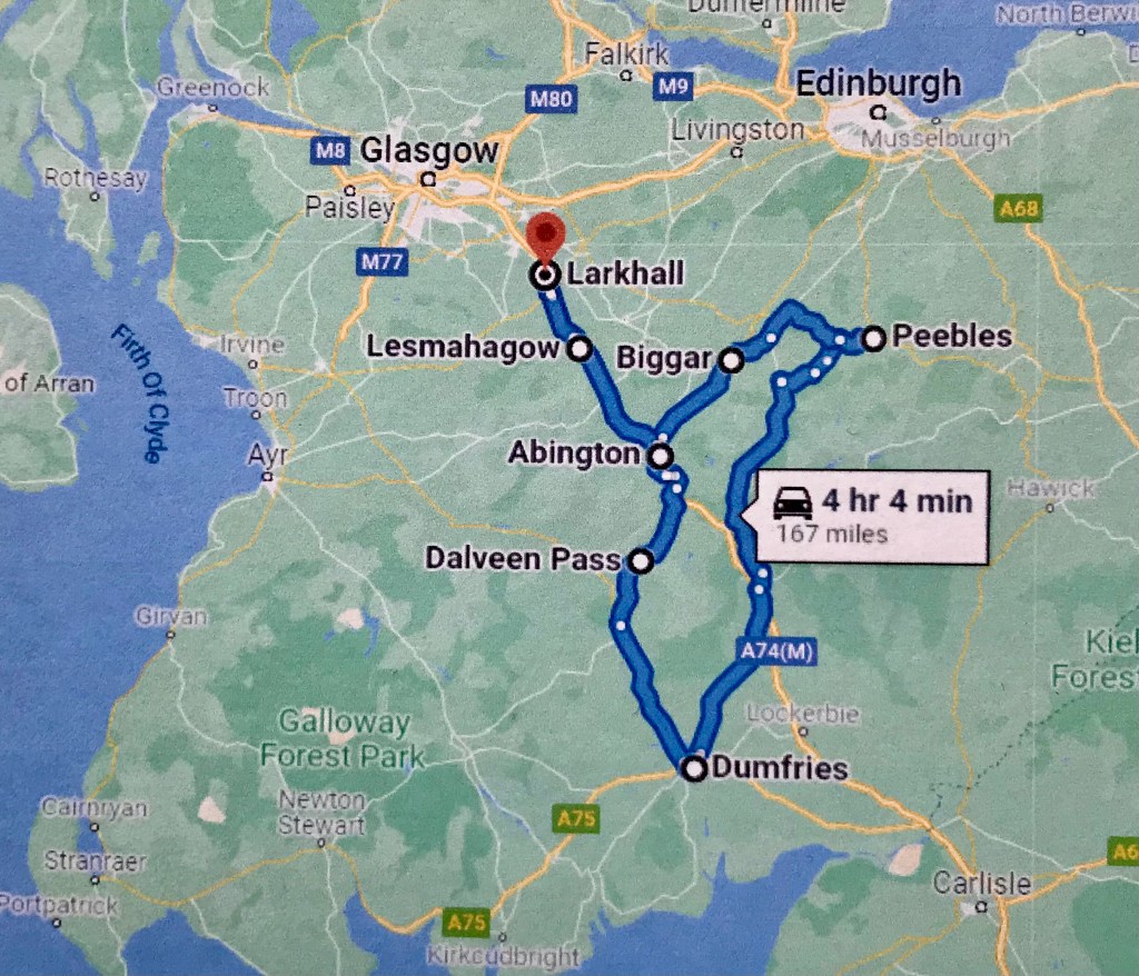
The trip begins at Larkhall, traveled to Dalveen Pass and on to Dumfries. They returned via Peebles, Biggar and Abington, passed Lesmahagow and back to Larkhall. I love google maps capabilities in that I can get street views at different stops to see what these places look like now.
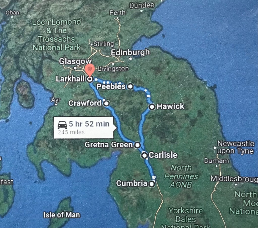
The second journey my Grand Uncle Walter took was a week later. It gave me a little trouble because google maps didn’t recognize a couple of the names. I learned that Cumberland Shire England is called Cumbria. I thought it said Leviot Hills but it is either Teviot Hills or Cheviot Hills. Teviot Hills seems most likely given the direction they were traveling. Here is the second trip.
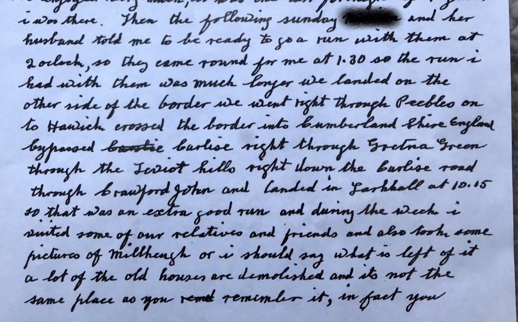
Here is the google maps version I came up with. Not sure if I will be able to take these trips but I can dream and imagine my ancestors traveling this same path. The trip began at Larkhall, through Peebles to Hawick. He crossed the border into Cumbria, bypassed Carlisle and drove through Gretna Green. The Teviot Hills are between Gretna Green and Crawford I believe. They drove through Teviot Hills, through Crawford and back to Larkhall.
The last map I created has the towns where my grandfather and his brothers and sisters were born. I definitely want to drive to Stevenston where my grandfather was born, and Larkhall where the family seemed to always return. This next map shows each of the towns where the family lived when one or more of their children were born. My great grandfather Walter Kirkwood (yes, my grand uncle has the same name) worked in the coal mines and all of these towns are located at different mines where he worked. Each of the sons began working in the mines at a very young age.

Stevenston, Larkhall, Carluke, Motherwell, Baillieston and Stirlingshire are all locations where my family lived. It kind of gives me chills to think of walking where they may have walked. These are my possiblity maps of places I would like to go one day. Hope it is soon. Have you mapped any trips to visit ancestral locations?
Enjoy the journey! Janet

Have you done the Google Street View of the route? It may satisfy your desire to see the sights until you can make the visit in person. Thanks for sharing!
LikeLike
Thank you Barb, I have used the street view for parts of the trip. I love that feature.
LikeLiked by 1 person